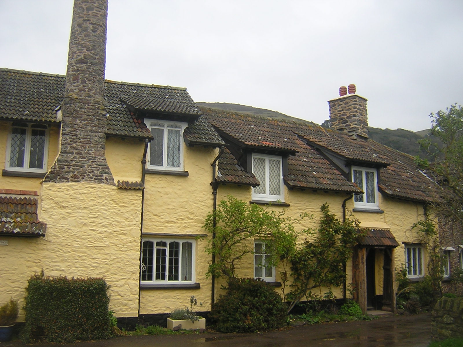
Our second night was spent at the Bottom Ship Inn in Porlock Weir. Not to be confused with the Top Ship Inn in the village of Porlock one and a half miles away.
 |
| The Bottom Ship Inn, Porlock Weir |
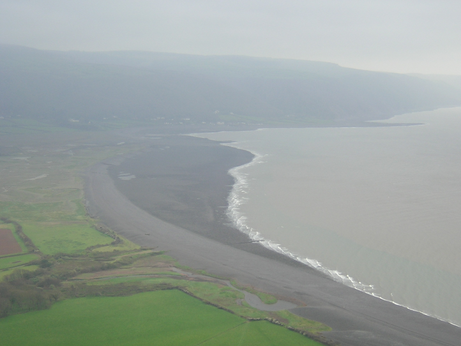
Porlock Weir is a tiny fishing hamlet, and has been a busy harbour for over 1000 years. It was visited by the Danes in 86AD and plundered by Anglo-Saxons in 1052. Thankfully, it's more peaceful now.
The Coast Path took us up towards the Worthy Toll House, where it costs 2 pounds per car (or horse carriage) to go up the steep hill towards Lynton, avoiding the even steeper Porlock Hill. However, walkers take the path to the right.
 |
| Worthy Toll House - we took the path under the arch |
The path led us through Yearnor Wood and under decaying tunnels, built long ago by Ada Byron, Lady Lovelace, daughter of the poet Lord Byron, to enable her to enjoy a network of carriageways through her ornate terraced gardens at the grand house at
Ashley Combe, now demolished.
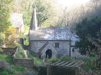
A pleasant woodland walk brought us to
Culbone Church, the smallest complete parish church in Britain. The chancel is 13.5 feet (4.1 m) x 10 feet (3.0 m), the nave 21.5 feet
(6.6 m) x 12.33 feet (3.8 m) and the building has a total length of 35
feet (10.7 m). It supposedly seats 33 people.... but it would definitely be a bit crowded.
 |
|
|
|
|
|
|
|
| The church at Culbone, dedicated to St. Beuno. |
|
|
|
|
|
|
St. Beuno was an important Welsh saint, born in the late 6th Century. He
rescued St. Winnifred from King Caradog, and died in 642AD. Celtic saints are often dedicated in West Country churches.
In the Assize Rolls of 1280, it is recorded that Thomas, the Chaplain of Culbone, was indicted "
for that he had struck Albert of Ash on the head with a hatchet, and so killed him". The people of Culbone are generally much more friendly nowadays.
 |
| Parts of the building are Saxon, before 1066AD, the screen is 14th Century. |
Three of the Rectors from 1348 to 1353 died
suddenly, probably from the Black Death which killed one third of
Britain’s entire population. In
1544 a leper settlement for 45 people was established and a tiny
window was built at the church to enable the lepers to see
the blessing of the sacraments. The window is still there, but the lepers are gone.
There are two small bells in the church..... one dates from the 17th
Century, and the other dates from the 14th Century and is the oldest
bell in West Somerset, and it still rings!
After a short stop at the church, on with our walk, We have a long way to go today.
 |
| The Coast path is well signposted, but the mileages never seemed to agree! |
 |
| Sisters Fountain |
Sisters' Fountain at Glenthorne, marked by a cairn and stone cross, is one of
many West Country sites associated with Joseph of Arimathea. He is
reputed to have stopped there to look for water whilst sailing up the
Channel to Glastonbury. Not finding any, he struck the ground with his
staff and water poured forth.
 |
| The gates to Glenthorne House |
 |
| Detail of the wild boars head on top of the gatepost at Glenthorne. |
We followed the driveway towards Glenthorne, but the Coast Path veered off before we got to the house itself. Too bad, as I'd have loved to see it. There's an old photo of the house
here. And the history of the Halliday family who built the house
here.
This day's walk was a long walk.... and we were all beginning to drag a bit as we made our way towards Lynton and Lynmouth. Lots of steep rugged uphill climbs, and even more downhill, if that's possible. As we neared our destination, we came out on open moorland, populated by sturdy Exmoor ponies.
 |
| The view from the Foreland and across Countisbury Hill to Lynton and Lynmouth. |
We staggered up the steps of our B&B exhausted after such a long and tiring walk, but after a cup of life-restoring tea and a piece of cake and a hot shower, we were ready to gobble down fish'n'chips at the Rising Sun Inn in Lynmouth.
 |
| The Rising Sun, Lynmouth |
The 14th Century thatched Rising Sun Hotel has oak panelling, crooked
ceilings, thick beachstone walls and creaking uneven floorboards. It was
in one of its rooms that R.D.Blackmore wrote several chapters of his
West Country classic Lorna Doone. And it is believed that the poet Percy Bysshe Shelley spent his honeymoon there with his 16 year old bride Harriet in 1812 after their elopement to Gretna Green.
The Adventure continues..........
For more about my trip to England and the South West Coast Path please scroll down to the previous post.
If you have done this part of the Coast Walk, please leave me a message and tell me about it!